Formula E returns to the ancient ruins of Rome. “Circuito Cittadino dell’EUR” is 2.84km in length, with a total of 21 turns. The start/finish line is located on Via Cristoforo Colombo, with the cars racing around the Obelisco di Marconi, against the backdrop of the iconic Colosseo.
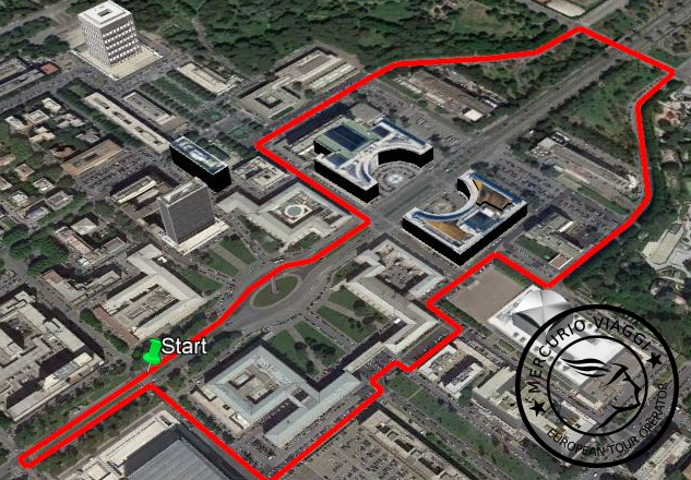
Circuito Cittadino dell’EUR – 3D Map by Google Earth Pro
With the E-Prix the itinerary of traffic of cars and buses will change. The last bus stop on Piazzale dell’Agricoltura will be moved to Piazzale Sturzo. The bus stop of Piazzale Douhet will be suspend. Via Cristoforo Colombo will be closed for four days from Via Laurentina ’till Viale dell’Oceano Atlantico.
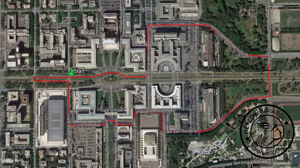
Circuito Cittadino dell’EUR – 2D Map by Google Earth Pro
All changes will be update by “Roma Servizi per la Mobilità”. We suggest to use the App Waze for driving or GoogleMaps or Moovit for using Bus.
Credits
Featured image by ABB Formula-E